Bristol's topography isn't just picturesque; it's a genuine engineering challenge. The steep Avon Gorge and the undulating terrain across Clifton and Totterdown aren't simply scenery—they are active, evolving slopes cut through Carboniferous limestone and weak Mercia Mudstone. When you combine the region's high annual rainfall of over 800 mm with the weathered sandstone layers that cap many hillsides, you get a landscape that demands rigorous analysis. We approach every project in Bristol by mapping the localised weathering profiles first, because a generic desktop study won't capture the transition zones where the bedrock drops away. To accurately model these conditions, we often pair field reconnaissance with a CPT test to profile the soft alluvial clays in the valley floor, or a seismic refraction survey to define the bedrock geometry beneath colluvium deposits.
A slope doesn't fail because the soil is weak; it fails because the water pressure finds a path the designer didn't see.
How we work
Local ground factors
The risk profile on a Clifton slope backing onto the Portway is fundamentally different from a shallow embankment on the floodplain near Avonmouth. In Clifton, you're dealing with a 60-metre high rock face that has a history of block falls; the hazard is a brittle, rapid detachment with almost no warning signs visible to a layperson. Down in Avonmouth, the problem is a slow, creeping rotational slip in the soft alluvial silts, often triggered by tidal fluctuations in the drainage channels. The common denominator in both cases is water. Bristol's wet winters saturate the ground, and uncontrolled surface runoff from paved areas in the city's many hillside terraces often gets directed straight onto vulnerable slopes. We've seen what happens when a retaining wall in the Front is designed without accounting for the surcharge load from the saturated backfill behind it—the wall doesn't just lean; it translates forward, pulling the road with it.
Relevant standards
BS EN 1997-1:2004 (Eurocode 7: Geotechnical design), BS EN 1997-2:2007 (Ground investigation and testing), BS 5930:2015 (Code of practice for ground investigations), CIRIA C580 (Embedded retaining walls), CIRIA C750 (Groundwater control)
Related services
Limit Equilibrium & FEM Modelling
We build 2D and 3D models using Slide2, Slope/W, or Plaxis to simulate both circular and non-circular failure surfaces in the Mercia Mudstone and Pennant measures.
Back-Analysis of Existing Landslides
Using geomorphological mapping and historic borehole records, we calibrate numerical models by matching observed slip surfaces to determine the in-situ residual strength parameters.
Rock Slope Assessment
For the Avon Gorge and disused quarries, we perform kinematic analysis for wedge and toppling failures per the Hoek-Brown criterion, combined with discontinuity surveys.
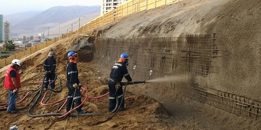
Remediation & Drainage Design
We specify and design horizontal drains, counterfort berms, and soil nail arrays to stabilise active slips, with a focus on maintaining the aesthetic of Bristol's conservation areas.
Typical parameters
Common questions
How much does a slope stability analysis typically cost for a project in Bristol?
For a residential or commercial project in the Bristol area, the fee for a detailed slope stability analysis generally falls between £870 and £3,310. The final cost depends on the slope height, the complexity of the ground model, and whether you require a simple 2D limit equilibrium check or a more sophisticated finite element analysis. We provide a fixed-price proposal after reviewing your site's topography and the existing ground investigation data.
Do I need a slope stability report for a planning application in Bristol?
Bristol City Council's planning department will almost certainly request a slope stability assessment if your site is on a gradient steeper than 15 degrees or is within the mapped landslide risk zones, particularly in areas like the Avon Gorge corridor or the steep valleys in the north of the city. The report must demonstrate that the development will not destabilise the slope or be at risk from ground movement, referencing BS EN 1997-1:2004 Design Approach 1.
What is the difference between a finite element analysis and a traditional limit equilibrium approach?
Limit equilibrium methods, like Bishop or Spencer, calculate the factor of safety by dividing the slope into slices and solving for force equilibrium; they assume the ground is a rigid-plastic material. Finite element analysis, which we run in Plaxis, models the actual stress-strain behaviour of the soil and can show you how the slope deforms before failure, including the development of tension cracks and the progressive failure mechanism. For complex Bristol sites with weak clay layers, FEM gives you a much more realistic picture of the serviceability limit state.
How do you account for tree roots and vegetation on a Bristol slope?
Vegetation is a double-edged sword in slope engineering. The mature broadleaf trees common on Bristol's hillsides, such as oak and ash, provide root reinforcement that can increase the shear strength of the upper 2-3 metres of soil by up to 5 kPa. However, that same vegetation extracts moisture from the clay during the summer, causing desiccation cracking and a reduction in strength when the autumn rains arrive. We model the root cohesion as an additional component in the soil strength envelope, but we always run a sensitivity analysis showing the factor of safety with and without this reinforcement, as trees can be lost to disease or future development.