The work usually starts with a CPT rig or a rotary coring setup positioned near Temple Meads or Bedminster. We bring the equipment right into the constrained urban plots of Bristol, running continuous push tests or wireline sampling to map the exact transition between the superficial alluvium and the underlying Mercia Mudstone. The floating harbour mud and the variable tidal deposits demand a precise stratigraphic model before any shield or sequential excavation begins. In our experience, skipping a dedicated Atterberg limits programme here means missing the sensitivity of the estuarine clays, which can remould rapidly under shear. A solid lab schedule, running parallel to the field investigation, is what turns a risky borehole log into a dependable tunnel alignment.
The Avon Valley’s buried channel deposits create a hydrogeological interface that drives pore pressure spikes during excavation—something generic models miss.
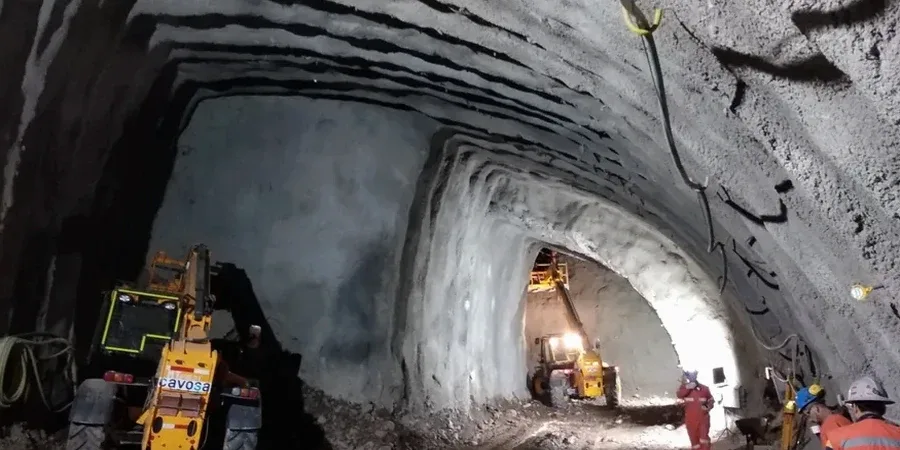
How we work
Local ground factors
Bristol’s population passed 472,000 in the 2021 census, and the pressure to build transport links and utilities underground keeps growing. A face collapse in the soft alluvium south of the Floating Harbour isn't just a construction setback—it can propagate to the surface within hours, affecting Victorian-era foundations and listed structures. We have observed that the biggest variable is not the mudstone bedrock, which is predictable, but the organic silts and peats that lie just above it. These materials lose strength rapidly with vibration or water ingress. Without a rigorous soft ground tunnel analysis that incorporates both the undrained behaviour during excavation and the consolidation settlement afterward, the long-term deformation can exceed the serviceability limits for adjacent buildings. The cost of remediation in a dense city like Bristol, with its narrow streets and protected architecture, far outweighs the cost of getting the ground model right from day one.
Relevant standards
BS 5930:2015 + A1:2020 Code of practice for ground investigations, BS EN 1997-1:2004 (Eurocode 7) Geotechnical design, with UK National Annex, BS EN ISO 22475-1:2021 Geotechnical investigation and testing — Sampling methods and groundwater measurements, CIRIA C760 Guidance on embedded retaining wall design
Related services
Site investigation and laboratory testing programme
We design and manage ground investigations using CPTu rigs and rotary coring to Class 1 sample quality. The lab schedule typically includes triaxial CIU, oedometer consolidation, Atterberg limits, and particle size distribution to characterise the alluvial sequence and the weathered Mercia Mudstone.
Tunnel alignment review and numerical modelling
Using the soil parameters from the lab and field data, we run plane-strain and 3D finite element models to assess face stability, lining loads, and surface settlement troughs. The output is a set of ground reaction curves and deformation predictions that the tunnel designer can use directly.
Typical parameters
Common questions
What makes soft ground tunnelling in Bristol different from other UK cities?
Bristol’s geology is dominated by the Avon Valley alluvium, with soft estuarine clays and peat pockets overlying Mercia Mudstone. The 13-metre tidal range on the Avon creates a dynamic groundwater regime that directly influences pore pressures in the near-river deposits. This means the ground model must account for tidal fluctuations, something that is less critical in inland cities.
How long does a typical soft ground tunnel site investigation take?
For a project in central Bristol, the field investigation phase usually takes three to five weeks, depending on access constraints and the number of boreholes. The advanced lab testing, including triaxial and oedometer tests, adds another six to eight weeks. We always factor in time for monitoring groundwater over at least one full spring tide cycle.
What is the typical cost range for a geotechnical analysis for a soft ground tunnel?
The cost for a comprehensive geotechnical analysis package, including site investigation, lab testing, and numerical modelling, typically ranges from £3,380 to £11,520 depending on the depth of investigation and the number of lab tests required. A project with multiple boreholes and a full triaxial suite will be at the upper end.
Can you coordinate with Bristol City Council and the Environment Agency?
We regularly liaise with both bodies, particularly for works near the Floating Harbour or the River Avon. The Environment Agency requires a flood risk activity permit for certain ground investigation works, and we manage that application as part of the overall programme. The council’s planning conditions for tunnels often require a detailed settlement assessment, which our modelling covers.