Bristol sits at roughly 11 metres above sea level, but its subsurface tells a far more varied story. The city straddles Carboniferous limestone, Triassic mudstone, and extensive pockets of compressible alluvial clay along the former courses of the Avon and Frome. Raft foundation design here is never a one-size-fits-all exercise. A proper scheme must reconcile differential settlement risk across these transitional zones, particularly where historic dock infill masks the original floodplain profile. The engineering team approaches each Bristol site by mapping the soil-structure interaction early, integrating CPT test results to define the stiffness profile before committing to a raft geometry. In the harbourside area, where groundwater sits within a metre of finished grade, buoyancy checks and waterproofing detailing are as critical as the bearing analysis itself. BS EN 1997-1:2004 governs the ultimate limit state verification, but the real value comes from interpreting the ground model with local experience of the Mercia Mudstone weathering profile.
A raft foundation in Bristol must work equally well on weathered Mercia Mudstone, saturated alluvium, and 19th-century dock fill—often within the footprint of a single building.
How we work
Local ground factors
One lesson learned from Bristol excavations is that the boundary between the alluvium and the underlying gravel terrace is rarely horizontal. When a raft bridges this sloping interface, the foundation can experience rotation that serviceability calculations do not always capture if the ground model is simplified. The risk becomes acute in the Redcliffe and Spike Island areas, where buried channels cut into the bedrock and the gravel pinches out abruptly. Ignoring these paleotopographic features leads to post-construction cracking in partition walls and misalignment of lift rails. The design team mitigates this by running sensitivity analyses on the raft stiffness matrix, varying the spring constants spatially rather than assuming a uniform bearing surface. In zones with a history of mining—Bristol's coalfield extends into the eastern parishes—the raft must also be assessed against the possibility of crown hole collapse, a scenario that requires a completely different reinforcement regime in the lower mat.
Relevant standards
BS EN 1997-1:2004 Geotechnical design – General rules (Eurocode 7), BS EN 1992-1-1:2004 Design of concrete structures (Eurocode 2), BS 5930:2015 Code of practice for ground investigations, BS 8102:2022 Protection of below ground structures against water ingress, BRE Special Digest 1 (concrete in aggressive ground)
Related services
Geotechnical interpretive report (GIR)
Synthesis of site investigation data into a 3D ground model with design parameters for the Mercia Mudstone, alluvium, and made ground layers, including characteristic values for undrained shear strength and constrained modulus.
Soil-structure interaction modelling
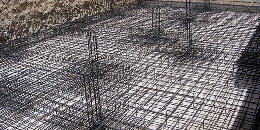
Finite element analysis using plate-on-spring and continuum models to capture differential settlement, raft bending moments, and contact pressure redistribution under service and ultimate loads.
Construction-phase monitoring specification
Detailed instrumentation plan for settlement markers, piezometers, and inclinometers during bulk excavation and slab casting, with trigger values aligned to the observational method under BS EN 1997-1.
Typical parameters
Common questions
What is the typical cost range for raft foundation design on a Bristol residential project?
For a standard two-storey residential raft in Bristol, the design fee typically falls between £800 and £1,400, covering the geotechnical interpretation, structural calculations, and reinforcement drawings. More complex projects on challenging ground—deep alluvium, contaminated fill, or within the tidal influence zone—can reach £2,200 to £3,420, reflecting the additional soil-structure interaction modelling and waterproofing detailing required.
How does the Mercia Mudstone affect raft foundation design in the city?
The Mercia Mudstone Group underlies much of Bristol and presents a classic weathered profile: near-surface desiccated clay with a stiff to hard consistency, transitioning to unweathered mudstone at depth. Its shrink-swell potential is moderate to high, meaning the raft must be designed to accommodate seasonal volumetric changes. We specify a compressible void former beneath the slab in the eastern suburbs where the weathering zone is thickest, and base the reinforcement on a hogging moment induced by edge shrinkage.
What ground investigation depth is required for a raft foundation in Bristol?
Per BS 5930:2015 and BS EN 1997-1, the investigation should extend to a depth of at least 1.5 times the raft width below the formation level, or to a depth where the stress increment is less than 10% of the in-situ effective stress. In Bristol's floating harbour area, this typically means 15 to 25 metres to penetrate the full alluvial sequence and confirm the bedrock profile, with rotary coring through the mudstone to prove competence below any weathered zone.